
Eskatarriff [Eisc an Tairbh]
Good walks are even better shared.
Overview
Eskatarriff [Eisc an Tairbh]
Overview
Nestled within the stunning Scottish Highlands, Eskatarriff invites adventurers to explore its rugged terrain. Standing at an elevation of 793 meters, this Marilyn offers an accessible hike for those craving both challenge and reward.
Geology
The mountain's geological makeup predominantly features schist, shaped by millennia of glacial activity. Its rocky outcrops reveal the powerful forces that shaped this landscape, providing a fascinating backdrop for those who appreciate geology as much as the views.
Routes
The most popular route to the summit begins at Ardgour, leading hikers through heather-covered moorlands. This 8.5-kilometre trek takes approximately 3.5 hours, classified as moderate in difficulty, perfectly suited for those looking to stretch their legs without over-exerting themselves.
Summit Features
At the summit, a quaint stone cairn marks the pinnacle of your efforts. This delightful little feature not only serves as a triumphal marker but also offers an ideal spot for a well-deserved break, snack in hand, to soak in the magnificent panorama.
Terrain
The terrain is a mixed bag of rocky pathways, grassy hillocks, and the occasional boggy section that’ll keep you on your toes. Remember to wear sturdy footwear; no one likes damp socks!
Views
As you stand atop Eskatarriff, the surrounding vistas will take your breath away. On a clear day, Loch Linnhe sparkles to the south, while Ben Nevis beckons to the north, providing hikers with a visual feast that rivals any postcard.
Hazards
Always keep an eye on the weather, as conditions can change at the drop of a hat in the Highlands. The rocky paths might be slippery, especially after rain, so tread carefully!
Nearby Summits
The charm of Eskatarriff extends beyond its peak, as neighboring summits like Ben Resipole and Beinn a' Bheithir await eager explorers.
Access
Finding your way to Eskatarriff is relatively easy. The nearest parking is located in the village of Ardgour. Public transport options are limited yet available from Fort William, the nearest town replete with facilities.
Facilities
After your hike, reward yourself with a visit to one of the inviting cafes in Fort William, where you can indulge in a slice of cake or a hearty meal to refuel.
History
Eskatarriff's name, derived from Gaelic, speaks volumes about the rich history and folklore surrounding the area. The mountain has long been a silent witness to the lives and stories of those who have walked its paths.
In summary, whether you're a seasoned hiker or a casual wanderer, Eskatarriff stands as a remarkable destination that encapsulates the wild beauty of Scotland. So grab your gear, and off you go; the hills await!
Explore routes near Eskatarriff [Eisc an Tairbh]
Public walks starting within 80 km of this hill. Nearby does not mean a route reaches the summit; check its map and access before setting out.
No public routes are currently listed within 80 km of Eskatarriff [Eisc an Tairbh] on Walkmates. This does not mean there are no paths here. Explore the map and check local access information before planning a walk.
Route planning notes
These notes describe possible approaches, not verified navigable routes or permission to cross land. Check current paths, local access rules and conditions before setting out.
Ardgour Approach
A scenic route starting from the village of Ardgour, leading up through open heather moorland and rocky terrain towards the summit.
Make a day of it, together
Find someone to share the walk with, or organise a day out along a route you like.
Hill facts and local notes
Classifications
Elevation
600m
1,970 ft
Prominence
136m
Coordinates
51.7186, -9.8291
V736533
OS Map
84
At the Summit
The summit is marked by a small stone cairn, offering a perfect perch for a well-earned snack while admiring the panoramic views.
Terrain & Geology
Primarily composed of schist, Eskatarriff's geology presents a rugged landscape that has been shaped by glacial activity. The rocky outcrops provide a glimpse into the ancient geological processes that have forged this beautiful region.
Views & Scenery
From the summit, hikers can enjoy breathtaking vistas of the surrounding mountains and lochs, particularly Loch Linnhe to the south and the impressive Ben Nevis range to the north.
History & Heritage
Name Origin
The name 'Eisc an Tairbh' translates to 'Fish of the Bull' in Gaelic, a reference to local folklore and the region's fishing heritage.
Historical Significance
Eskatarriff is significant for its historical associations with ancient clans and its striking natural beauty; a perfect example of the quintessential Scottish landscape.
Getting There & Facilities
Check current local access restrictions, parking rules and transport timetables before travelling. These notes do not confirm public access to the summit.
Parking
There is a small parking area at the Ardgour village. Arrive early, especially in summer, as spaces may fill up quickly.
Public Transport
Limited bus services operate to Ardgour from Fort William, but check local timetables for current schedules.
Nearby Facilities
The nearest facilities are found in Fort William, which offers cafes, shops, and public toilets.
Safety Information
Known Hazards
- Beware of rocky outcrops and slippery paths; the weather can change rapidly, so be prepared for sudden rain showers or gusty winds.
General Safety Tips
- Check weather conditions before setting out
- Carry appropriate clothing and equipment
- Let someone know your planned route
- Take a map, compass, and GPS device
- Carry emergency supplies: food, water, first aid kit, torch
Hills
Some common questions about the hills answered
Are there group walks up Eskatarriff [Eisc an Tairbh]?
Many walkers use Walkmates to join or organise walks with others. You can check for group walks around Eskatarriff [Eisc an Tairbh] through the maps
Are there other walkers around Eskatarriff [Eisc an Tairbh]?
Activity varies by location and time, but Walkmates lets you see whether others have shared walks or shown interest in this area. Find other people through the walking friends search walking friends for Eskatarriff [Eisc an Tairbh] search or of course create your own walk for Eskatarriff [Eisc an Tairbh]
Can I organise a walk to Eskatarriff [Eisc an Tairbh]?
Yes. If there aren’t any walks listed already, you can create a walk and make it available for others to join.
If you're signed up to Walkmates, you can create a walk to Eskatarriff [Eisc an Tairbh].
How do I find a walk up this hill?
There are often multiple ways to walk this hill, depending on experience and route preference. Walkmates helps you explore walks and routes that others have shared.
Can I suggest a new route up Eskatarriff [Eisc an Tairbh]?
Yes. You can suggest or create routes to share with others. Walkmates focuses on the social side of walking, so routes are used to help people organise walks and explore areas together, rather than as detailed navigation tools or route libraries.
Other uses really appreciate knowledgeable walkers sharing their routes. Share your favourite route to Eskatarriff [Eisc an Tairbh] here
The is an error or something incorrect about this hill. How do I let you know?
We always strive to keep the information on Walkmates as accurate as possible. If you find an error, please let us know through the contact form and we'll aim to correct it as quickly as possible
Community Discussion
Comments
Location
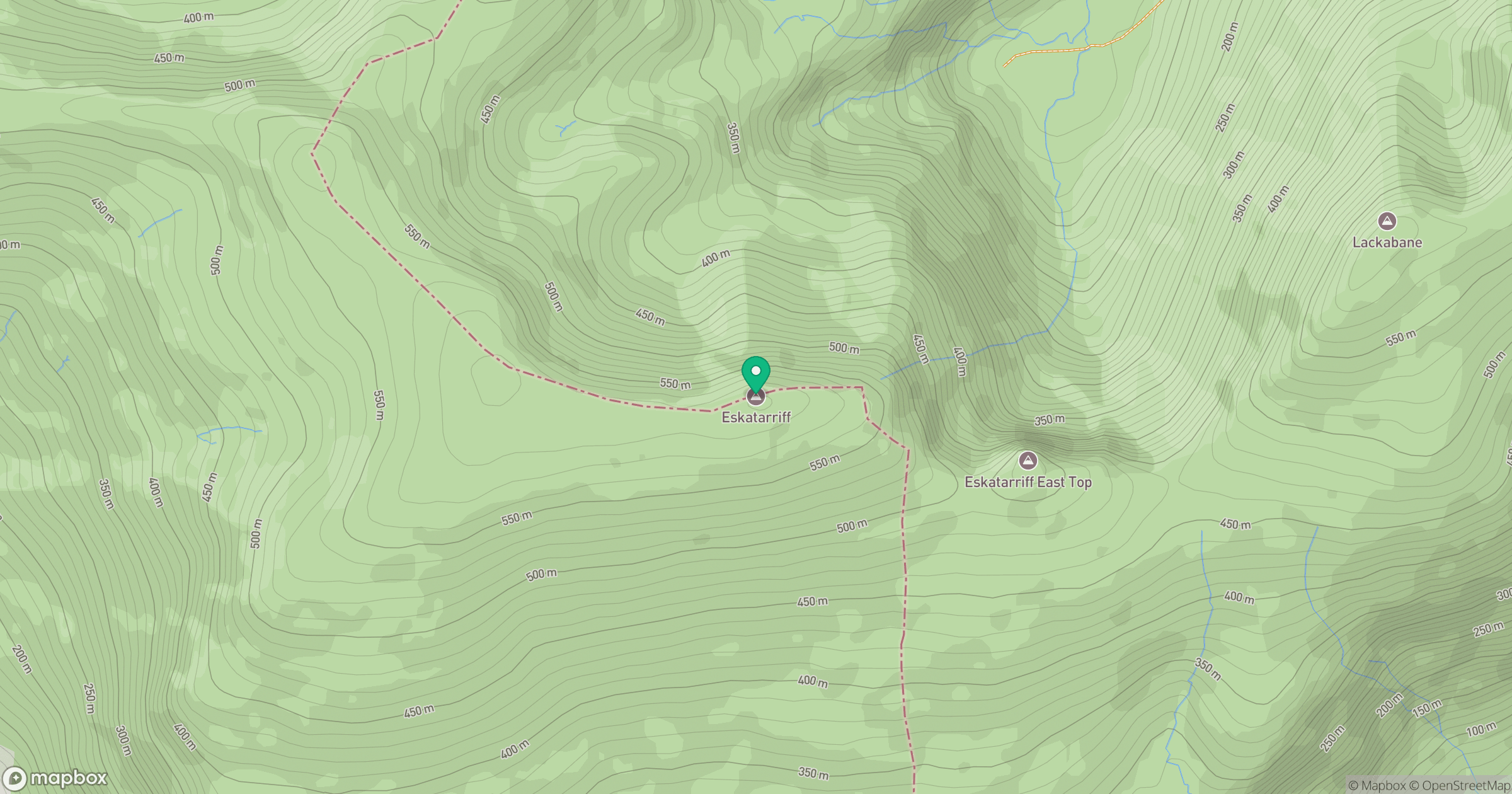
Grid reference: V736533
View on OpenStreetMapOpens a map in a new tab, centred on the hill.
Hills within 30 km
Straight-line distance, not a walking route or confirmation of access.
Coomacloghane [Com an Chlochain]
599m
Lackabane [Leaca Bhan]
603m
Knocknagree [Cnoc na Groi]
586m
Maulin [Malainn]
621m
Hungry Hill [Cnoc Daod]
685m
No comments yet. Be the first.